Coast to Coast: Section 12 - Grosmont to Robin Hood’s Bay
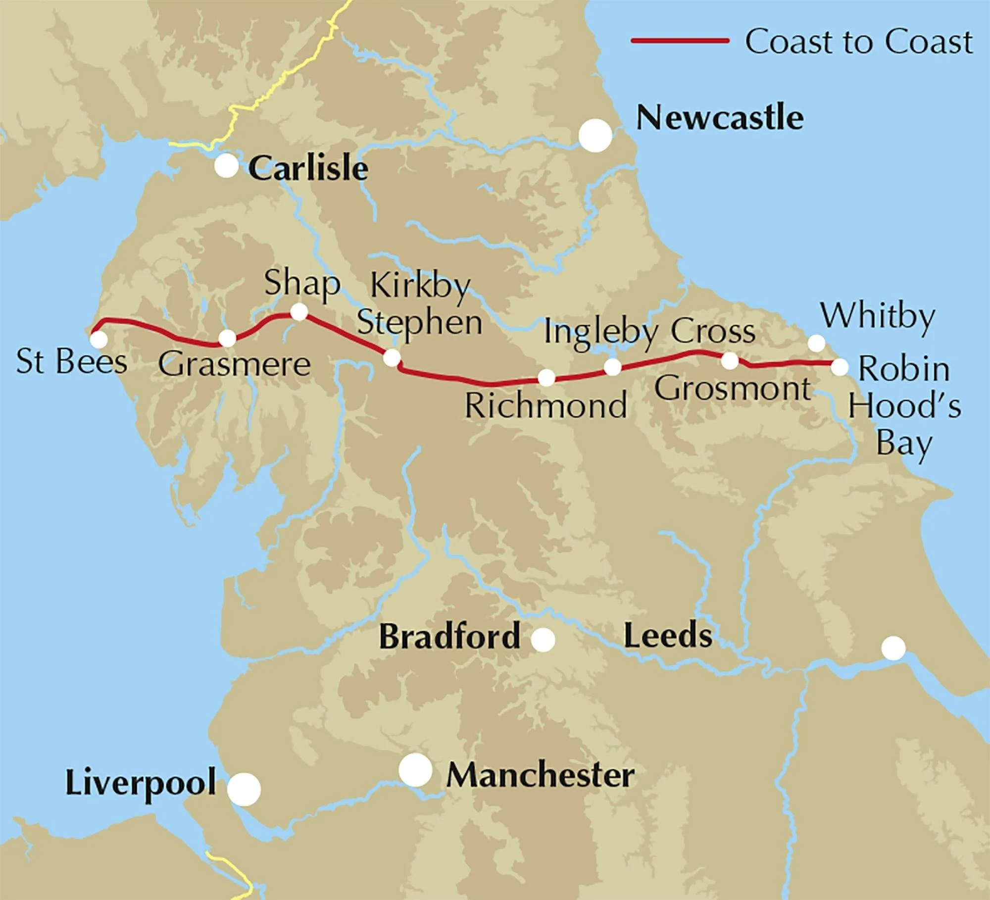
Spanning nearly 200 miles across northern England, from St Bees in Cumbria to Robin Hood’s Bay in North Yorkshire, the Coast to Coast walk was devised by Alfred Wainwright in 1973 and takes in three national parks; the Lake District, the Yorkshire Dales and the North York Moors.
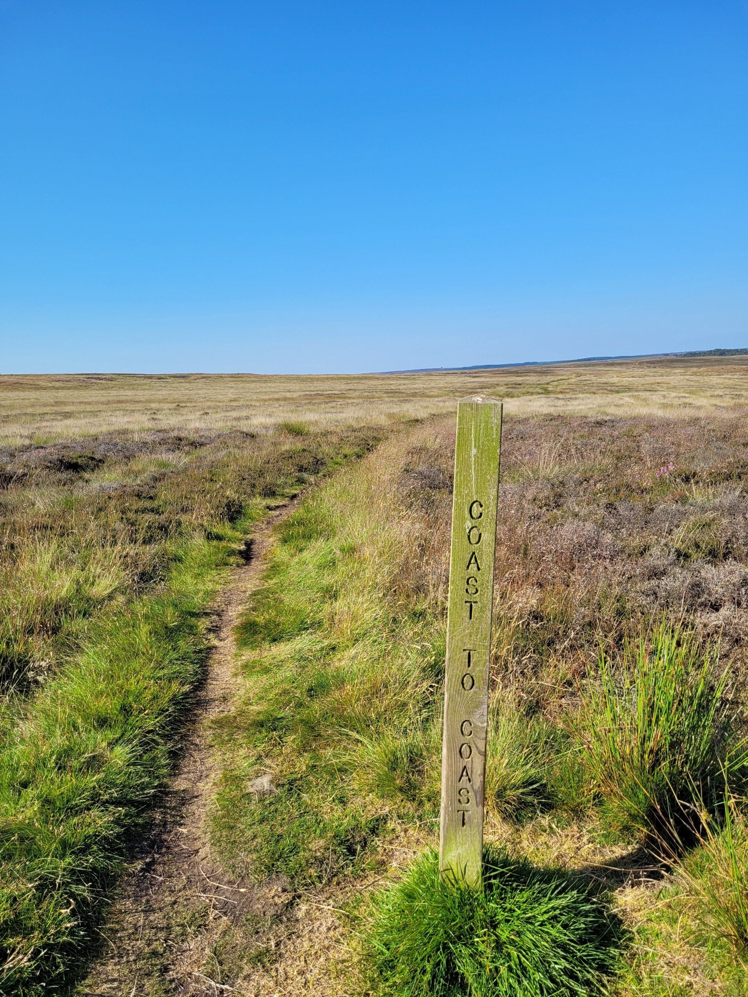
Alfred Wainwright was an experienced long distance fell walker and created the route from the Irish sea to the North sea by joining pre-existing footpaths, bridleways and national park routes. Some sections of the walk are still not well marked out but this section which we walked in June 2022 was very well signposted.
With nearly 20,000ft of ascent throughout the trail the entire route is a strenuous hike and walkers should be well equipped when traversing such rugged landscape. It is recommended that you set aside a minimum of two weeks to conduct the full route in one direction. There are 12, 13, 14, and 16 day itineraries available online to help you plan.
The section we completed from Grosmont to Robin Hood’s Bay is considered to be the final leg of the Coast to Coast walk and is doable in a day; although it is 15.5 miles and a difficult hike. We completed this section as we were holidaying in Beckhole, a 2.5 mile walk from Grosmont; so we actually started in Beckhole for our hike, making our route 18 miles long.
Start/end point: Grosmont - Robin Hood’s Bay
Average duration: 6.5 - 8.5 hours (we did it in just under 6.5 hours)
Distance: 30km
When to go: April to September
Difficulty: Moderate/Strenuous
Maps/Info: This section of the coast to coast walk is very well signposted,
Downloadable brochure available to buy for £12.99:
https://www.coasttocoast.uk/route-map/
All Trails provides a great downloable map which will sync onto Google maps/Maps me/other formats as required:

At 4.30am on a chilly but clear June morning we started our walk from Beckhole to Grosmont to join the official Coast to Coast trail. This was a 2.5 mile addition to the main route, but was fairly flat and even ground as it was along a disused rail route turned walking route. As we neared Grosmont we knew that a steep uphill was coming; we’d been to Grosmont the day before on the North York Moors railway and had spied the ascent out of the town.
The route out of Grosmont takes you sharply uphill at an almost unwalkable gradient up Front street and onto Fair Head lane; climbing the whole time. It was from up here that we looked back towards Grosmont and could see the most incredible view over the undulating landscape of the Moors. The sun was rising, the sky a clear blue and there was some low-lying mist which had yet to be burnt through by the heat of the day. These things combined to create a magnificent vista so we stopped to pause a while to admire it, and to get our breath back!

At this stage you will have reached a plateau on the walk and soon find yourself tramping over nice spongy moorlands where sheep are roaming wild, herds of deer gather for their morning meetings and all around you is vast green moors. Continuing on, you will need to hike alongside the main Whitby Road for a short distance before crossing over, following a route marker off to the right and heading back onto moorland for a mile or so, steadily going downhill towards Littlebeck.
A charming village with a lovely chapel, Littlebeck is worth lingering and wondering around; there are plenty of information boards sharing local history, moorland tales and pointing out footpaths around the area should you want to visit more of the national park.

After the quite difficult descent down into Littlebeck (I always find downhills harder on the knees and hips; having to slow myself down to stop from cartwheeling down the side of hills and mountains has always been something I find difficult) the relief is short-lived as you will need to climb back out of this tiny hamlet! What goes down must come up in this National Park.
You will find this section of uphill walk quite different to the rest of the hike as you are sheltered from the weather by deciduous trees and ferns in the Littlebeck Woods Nature Reserve. Keep an eye out for rare moorlands flora and fauna in this hidden haven which feels more rainforest than national park. A gentle uphill climb through the woods keeps you alongside a stream which eventually culminates into the Falling Foss waterfall; a fantastic place to stop for a drink if the on site café is open, or alternatively have your pre-packed picnic. We halted here to admire the view for a while, drinking our flask of coffee and eating cereal bars.

Continuing on alongside May Beck stream you climb uphill at an even pace, coming out of the woods. You meet a road - May Beck Farm Trail - which takes you uphill at a sharp angle, hugging the side of a hill for some time. You then reach another waymarked coast to coast sign which takes you over fields for around a mile, heading towards the B1416 road. Take a right on this main road and follow it for a short distance; there is ample room to walk alongside rather than on the road.
A footpath takes you off the main road to the left hand side and over craggy moorlands which are fairly flat compared to the rest of the walk. You will soon come to Stainsacre Lane which leads you onwards to Back Lane. Follow these small country roads until you get into High Hawsker. The biggest village on the route aside from the final destination, High Hawsker boasts two pubs, hotels and a lovely village green. We paused on a bench here in the now hot and sunny morning light to have a breather and some more coffee and water.
Onwards from here down Bottoms lane and through the Northcliffe and Seaview holiday parks, you pass the lovely Coast café which is well worth a stop for a drink or bite to eat. You will see the sea from this holiday park, and your inner compass will lead you in the right direction as you follow the footpath down to the cliff edge. You then turn right, joining up with the Cleveland way trail. You have reached the coast, but you aren’t quite in Robin Hood’s Bay yet. The views are spectacular along this last section of the Coast to Coast walk.

2 miles to go! Carry on - directions here are keep the sea on your left and you will find yourself sticking to the Cleveland way with well marked signposts the entire way to Robin’s Hood Bay. A glorious 2 mile walk in any weather, but especially fantastic on the sunny day we were gifted. Views of endless sea to the left of you and moor-like fields to the right of you. The very last section of the walk is quite a sharp descent into the town of Robin Hood’s Bay, where ample cafes, pubs, outdoor shops and ice-cream vendors await!
We spent the next few hours in this town, sunbathing and mooching around, before having lunch in a central pub. A quaint fishing village with a lively bustle in the summer from visiting tourists, Robin Hood’s Bay is well worth a visit regardless of the walk so make sure you find the time to soak it up.

